Difficulty: Easy on the GR 221 trail, medium on the Serra des Puntals routes & Mola circuit
Duration: Estellencs to Banyalbufar on GR 221 4/5 hrs, Estellencs to Esporles 5/6 hrs.
Mola de Planicia circuit from Banyalbufar or Sa Granja 6/7 hrs
High route Estellencs/ Galatzo/Col d'Estellencs/ Serra des Puntals/ Banyalbufar (or Esporles via Son Vic): over 8 hrs.
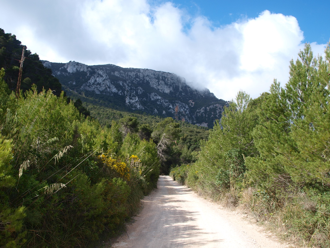
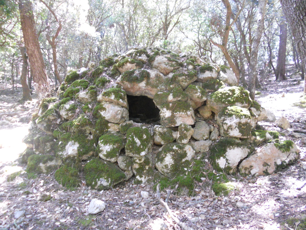
The Mola de Planicia is a fairly large mountain, culminating just under 1000 meters. Its wooded slopes were exploited intensively till last century by charcoal and limestone makers; a vast network of ancient trails criss cross the mountain sides, going from kiln to kiln and charcoal platform to charcoal platform. A few of the major ancient trails are still in very good condition, and give an interesting insight in the forest exploitations of a bygone era.
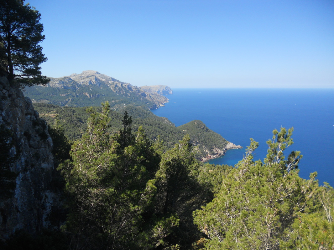
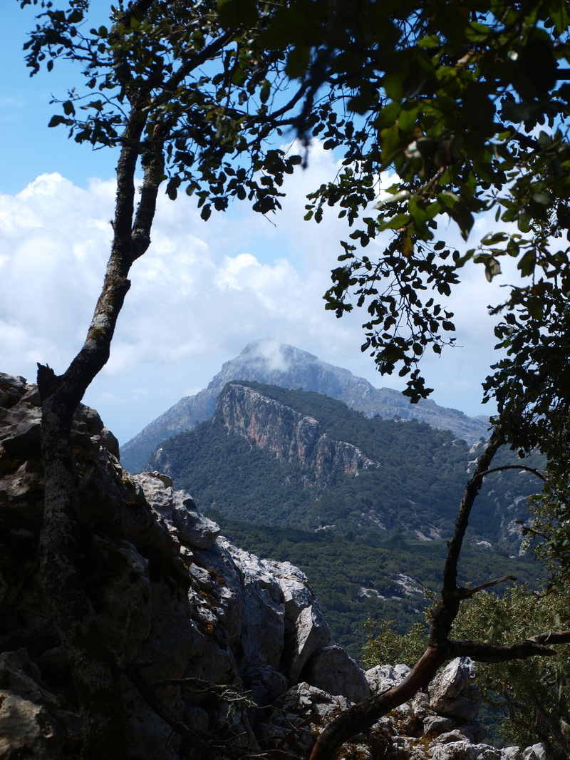
The massif lacks the wow factor of its neighbours to the south (Galatzo) or of the Teix range to the North. Because of the dense woods, there are only few view points. The Mola de Planicia circuit is a pleasant outing from Palma, but visitors with limited time should really concentrate on other areas which offer more impresssive scenery.
Those hiking the 221 can enjoy a pleasant stage between Estellencs and Esporles or Banyalbufar, going through the impressive public Finca of Planicia. The way can be made a lot more exciting by including a hike to the summit of Galatzo, followed by the Serra de Puntals, Mola de Planicia summit and down to Banyalbufar.
Note that the Cami des Rotasses going down to Esporles from the Mola summit is difficult to follow, and should only be attempted by people with good orienteering skills, allowing plenty of daylight should you loose your way in the dense woods.
Duration: Estellencs to Banyalbufar on GR 221 4/5 hrs, Estellencs to Esporles 5/6 hrs.
Mola de Planicia circuit from Banyalbufar or Sa Granja 6/7 hrs
High route Estellencs/ Galatzo/Col d'Estellencs/ Serra des Puntals/ Banyalbufar (or Esporles via Son Vic): over 8 hrs.
The Mola de Planicia is a fairly large mountain, culminating just under 1000 meters. Its wooded slopes were exploited intensively till last century by charcoal and limestone makers; a vast network of ancient trails criss cross the mountain sides, going from kiln to kiln and charcoal platform to charcoal platform. A few of the major ancient trails are still in very good condition, and give an interesting insight in the forest exploitations of a bygone era.
The massif lacks the wow factor of its neighbours to the south (Galatzo) or of the Teix range to the North. Because of the dense woods, there are only few view points. The Mola de Planicia circuit is a pleasant outing from Palma, but visitors with limited time should really concentrate on other areas which offer more impresssive scenery.
Those hiking the 221 can enjoy a pleasant stage between Estellencs and Esporles or Banyalbufar, going through the impressive public Finca of Planicia. The way can be made a lot more exciting by including a hike to the summit of Galatzo, followed by the Serra de Puntals, Mola de Planicia summit and down to Banyalbufar.
Note that the Cami des Rotasses going down to Esporles from the Mola summit is difficult to follow, and should only be attempted by people with good orienteering skills, allowing plenty of daylight should you loose your way in the dense woods.
|
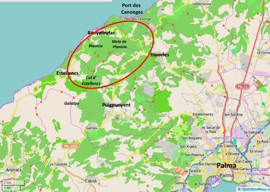
Getting There
Bus service 200 links Palma with Esporles, Sa Granja, Banyalbufar and Estellencs. For the Mola de Planicia loop, Sa Granja is the best starting point, although it also possible to start from Banyalbufar; this last options adds a couple of hundred meters in elevation gain. For those driving, Sa Granja has a large free car park. The Cami De Correu starts about a kilometer north on the main road to Banyalbufar. Those who just wish to visit the Finca Planicia can park on the main road between Banyalbufar and Estellencs in the dedicated car park. There is also a bus stop here. |
|
The Hikes
Estellencs to Banyalbufar and/or Esporles via Planicia along the main GR 221 trail
The GR 221 main trail leaving Esporles is well signposted, and starts of below the main road before rejoining it about a km to the east of town. The next km is spent walking on the main road, after which a trail (also signposted) will lead you uphill to the right above the main road this time.
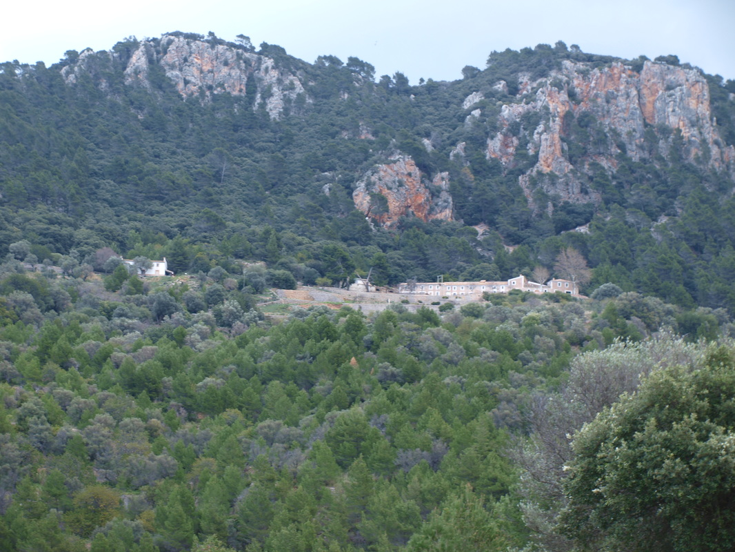
Follow this trail for just over a kilometer, till you reach a small asphalted road closed to general car traffic, leading to Finca Planicia. Take a right here up to the Finca that can be clearly seen high above on the hill side.
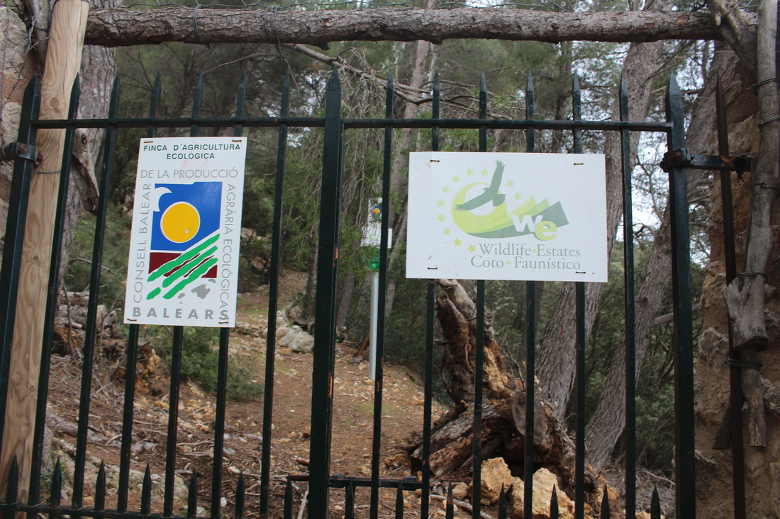
The old GR 221 trail went straight ahead, but was closed off by a landowner of northern European origins some years ago, who purchased finca Es Rafall through which the hiking route went ; this gentleman's intention was to develop yet an other luxury agrotourismo, through which plebeian hiking crowds could not possibly be allowed to pass. The whole issue has been food for lawyers ever since and is likely to remain in court for years to come; the finca agroturismo project never took off nor did the path reopen. The finca is currently a self appointed 'biological reserve', a status mostly aimed at keeping hikers out.
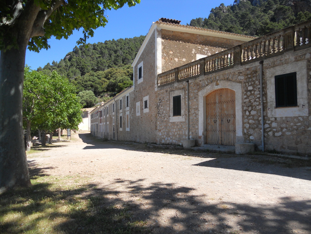
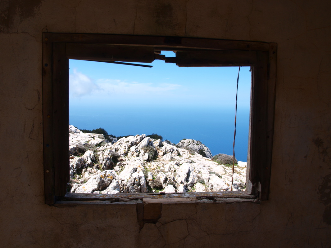
Anyway, you will now have to walk all the way up to the pretty municipal Finca de Planicia. Have a look through the windows to peek at the old farm setup that has remained untouched for years.
Continues on the main path in front of the farm, past the last outbuilding on the north east and take trail going up hill on the right straight after. The way is cairned and marked after this, taking you up above the Es Rafall property and following its northern border.
You will arrive in less then an hour to a junction, where you take a left downhill followed by a right on a dirt road, past Finca S'Arboçar with its old carts parked outside. Keep on on the dirt road, pass a gate and go up a hill till you reach a coll and a minor road junction.
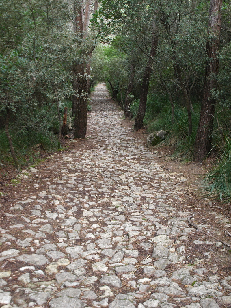
Left will take you down to Banyalbufar, 30 minutes away. Right will take you on the well marked and beautifully maintained dry stone route of the Cami de Correu to Sa Granja and Esporles, two hours away.
The GR 221 main trail leaving Esporles is well signposted, and starts of below the main road before rejoining it about a km to the east of town. The next km is spent walking on the main road, after which a trail (also signposted) will lead you uphill to the right above the main road this time.
Follow this trail for just over a kilometer, till you reach a small asphalted road closed to general car traffic, leading to Finca Planicia. Take a right here up to the Finca that can be clearly seen high above on the hill side.
The old GR 221 trail went straight ahead, but was closed off by a landowner of northern European origins some years ago, who purchased finca Es Rafall through which the hiking route went ; this gentleman's intention was to develop yet an other luxury agrotourismo, through which plebeian hiking crowds could not possibly be allowed to pass. The whole issue has been food for lawyers ever since and is likely to remain in court for years to come; the finca agroturismo project never took off nor did the path reopen. The finca is currently a self appointed 'biological reserve', a status mostly aimed at keeping hikers out.
Anyway, you will now have to walk all the way up to the pretty municipal Finca de Planicia. Have a look through the windows to peek at the old farm setup that has remained untouched for years.
Continues on the main path in front of the farm, past the last outbuilding on the north east and take trail going up hill on the right straight after. The way is cairned and marked after this, taking you up above the Es Rafall property and following its northern border.
You will arrive in less then an hour to a junction, where you take a left downhill followed by a right on a dirt road, past Finca S'Arboçar with its old carts parked outside. Keep on on the dirt road, pass a gate and go up a hill till you reach a coll and a minor road junction.
Left will take you down to Banyalbufar, 30 minutes away. Right will take you on the well marked and beautifully maintained dry stone route of the Cami de Correu to Sa Granja and Esporles, two hours away.
High route:
Estellencs to Puig de Galatzo to Col d'Estellencs to Serra de Puntals, Mola de Planicia & Esporles/ Banyalbufar
Estellencs to Puig de Galatzo to Col d'Estellencs to Serra de Puntals, Mola de Planicia & Esporles/ Banyalbufar
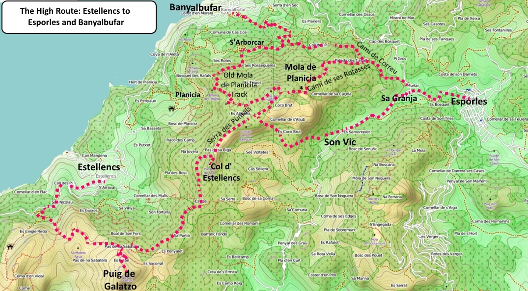
This is a long hike whichever way you do it, made extra long if you add to it the Puig de Galatzo and Mola de Planicia summits on the way. It is also the most scenic and interesting way to hike from Estellencs to Banyalbufar or Esporles, but should only be attempred by fit walkers. Allow more then 8 hours of difficult and solid walking.
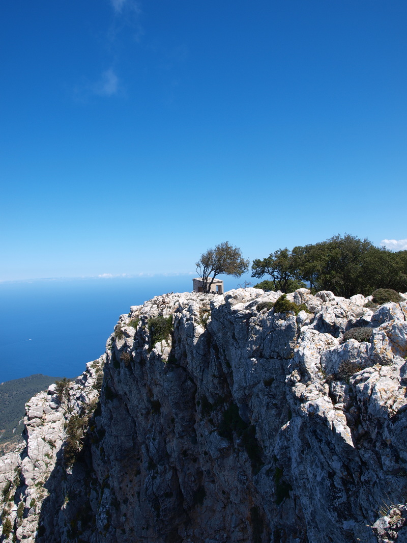
Start off as for the Galatzo walks from Estellencs. on the Galatzo trail, and head up the wide and well signposted track winding its way up the hill. Ignore the turn off on the right towards Esclop; at the next junction, take a right and wind your way up the pas des Cossis. The scenery opens up and becomes more barren once over the pas; follow the trail down and up around a gully and up to a small col, on rocky terrain all the way to the next junction, at Pas de Sabatera where you take a right (you will chose the straight ahead option on the way down from Galatzo summit). You are now climbing steeply towards the summit; one more turn off to the right (straight ahead goes to Font de Pi, signposted) and you are half an hour from the top of Galatzo, climbing steeply on very rocky ground. After a couple of small scrambles, you will join the other hikers at the summit and enjoy the great views over west Mallorca and Estellencs, a long way down.
Return the way you came, down to the Pas de na Sabatera and take a right on the path heading through the forest. You will soon reach a minor turn off to Font de Dalt; take the faint track towards the font, pass some ruined walls and huts, and look attentively for a trail continuing ahead at a more or less level gradient eastwards. The trail is quite distinct and relatively popular with off road cyclists. Follow this for an other 30 to 45 minutes, deep in the forest all the way; you eventually will come to a junction with a much larger track, where you take a left to the Col d'Estellencs 3 minutes away, with its distinctive boundary wall and stile.
You can bail out here and go straight ahead toward Puigpunyent or Esporles along the easier trails (1 1/2 and 3 hrs). Finca Sa Campaneta is an accommodation option close by.
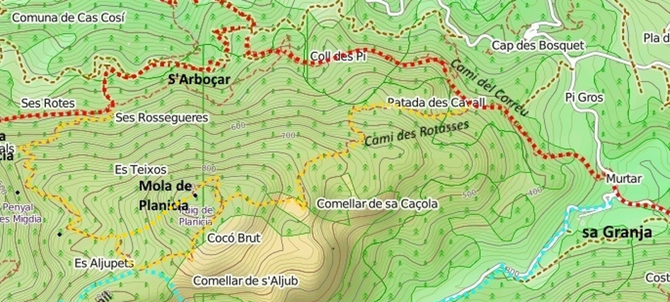
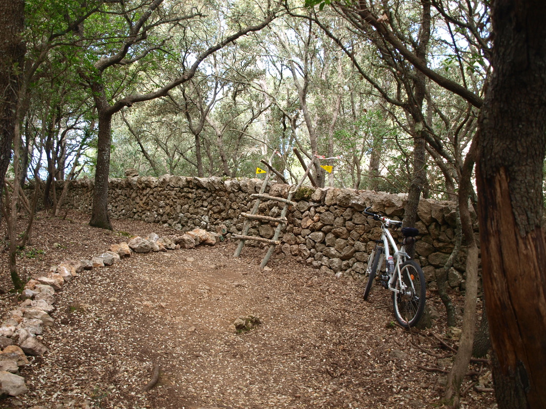
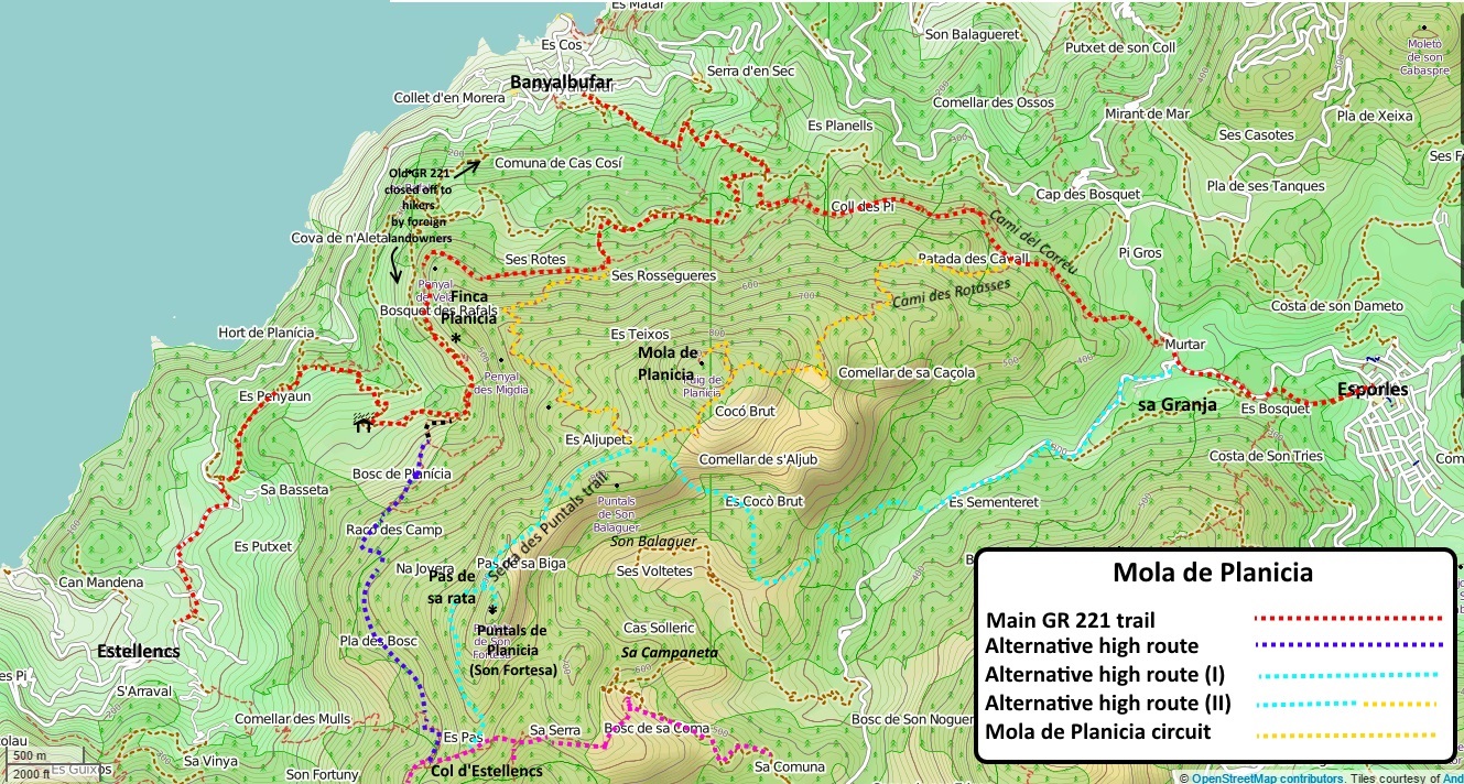
For those fit enough to continue, go over the style or through the gate and look on the flat ground of the col a short distance away for a cairn indicating a faint trail on the left leading up to the Serra des Puntals (turquoise on the map). This trail is quite faint but well cairned, and involves negociating a rather steep scramble (pas de sa Rata) up a gully just before the Puntal de Planicia (also called Puntal de Son Fortesa) reached on short one way track on the right. You will eventually ( 1 1/2 to 2 hrs) arrive on the beautifully built ancient trail of the Mola de Planicia. from where you have the option to descend towards Esporles by taking a right (either via son Vic -easyish- or on the Cami de ses Rotasses - very faint, difficult route finding) or towards Banyalbufar by taking a left.
Start off as for the Galatzo walks from Estellencs. on the Galatzo trail, and head up the wide and well signposted track winding its way up the hill. Ignore the turn off on the right towards Esclop; at the next junction, take a right and wind your way up the pas des Cossis. The scenery opens up and becomes more barren once over the pas; follow the trail down and up around a gully and up to a small col, on rocky terrain all the way to the next junction, at Pas de Sabatera where you take a right (you will chose the straight ahead option on the way down from Galatzo summit). You are now climbing steeply towards the summit; one more turn off to the right (straight ahead goes to Font de Pi, signposted) and you are half an hour from the top of Galatzo, climbing steeply on very rocky ground. After a couple of small scrambles, you will join the other hikers at the summit and enjoy the great views over west Mallorca and Estellencs, a long way down.
Return the way you came, down to the Pas de na Sabatera and take a right on the path heading through the forest. You will soon reach a minor turn off to Font de Dalt; take the faint track towards the font, pass some ruined walls and huts, and look attentively for a trail continuing ahead at a more or less level gradient eastwards. The trail is quite distinct and relatively popular with off road cyclists. Follow this for an other 30 to 45 minutes, deep in the forest all the way; you eventually will come to a junction with a much larger track, where you take a left to the Col d'Estellencs 3 minutes away, with its distinctive boundary wall and stile.
You can bail out here and go straight ahead toward Puigpunyent or Esporles along the easier trails (1 1/2 and 3 hrs). Finca Sa Campaneta is an accommodation option close by.
For those fit enough to continue, go over the style or through the gate and look on the flat ground of the col a short distance away for a cairn indicating a faint trail on the left leading up to the Serra des Puntals (turquoise on the map). This trail is quite faint but well cairned, and involves negociating a rather steep scramble (pas de sa Rata) up a gully just before the Puntal de Planicia (also called Puntal de Son Fortesa) reached on short one way track on the right. You will eventually ( 1 1/2 to 2 hrs) arrive on the beautifully built ancient trail of the Mola de Planicia. from where you have the option to descend towards Esporles by taking a right (either via son Vic -easyish- or on the Cami de ses Rotasses - very faint, difficult route finding) or towards Banyalbufar by taking a left.
- To Banyalbufar: take a left. For those with enough energy left to climb to the summit of the Mola de Planicia, a cairned route starts on a sharp bend a small distance ahead on the main track, leading to the summit of the Mola de Planicia in 20/25 minutes. The junction is cairned and the way up leads you along a very steep gully towards the summit, with quite a bit of scree. Return the same way as you went up and continue down on the main path, toward Banyalbufar through the charcoal and lime kiln settlement of Ses Ajubets. The old donkey track is well built and easy to follow all the way down to a dirt road, that you follow on the right. You are now back on the main GR 221 trail, pass Finca S'Arboçar with its old carts parked outside. Keep on on the dirt road, go through a large gate and a hill till you reach a coll and a minor road junction. Take a left to Banyalbufar, a further 30 minutes away.
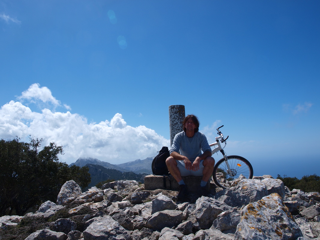
- To Esporles: take a right. The quick way to Esporles is to take a sharp right on a faint cairned trail almost right at the junction of the Serra des Puntals trails and the Mola de Planicia trail. This track is cairned all the way but poorly defined and goes down a steep gully towards son Vic. It is a fast way down from the Mola, and you will rejoin the main road linking Esporles and Puigpunyent just bellow the grand Finc son Vic de Suprema in about 1 1/2 hour. A further 45 minutes walk on the asphalt will bring you down to Sa Granja. The slow way to Esporles is to continue on the main Mola de Planicia summit path, proceeding slowly upwards to reach the summit (or summits, there are two of them) in about 30 to 45 minutes. Enjoy the view and backtrack for a few hundred meter; look carefully for a very poorly cairned and faint trail to the left heading north east. Follow this ( note: this is hard and unless the trail has been re cairned, you are almost guaranteed to lose you way a few times so allow plenty of spare time and daylight to come down the mountain this way). there are quite a few charcoal platforms and kilns along the way. You should eventually reach a bigger, better defined trail, the Cami des Rotasses, that will take you to dry stone Cami de Correu, on the main GR 221 route to Esporles.
Mola de Planicia circuit
This is a nice day hike out of Palma, that fails to be great because 2/3 of the way is spent in dense forest. The view from the Mola summit are pretty.
Start off at Sa Granja, Esporles, and take the Cami De Correu towards Banyalbufar. Less then 30 minutes along the Cami de Correu, a path branches off to the left going up hill. There is a wooden post showing the way forward on the traditional GR 221 at the intersection. Take this fairly wide side path, the Cami de ses Rotasses all the way up; this path was built to link charcoal platforms and lime kilns in the forest. Just keep going up on the main path; you will reach a collapsed cistern; keep going up, till you reach the marked (paint) trail going through a boundary wall. Keep going up, looking for markers, sometimes steeply, at other times on old faint footpaths, past numerous platforms and kilns towards the summit. You will eventually rejoin the main Mola de Planicia summit trail, that you follow to the right to the two summits. Getting here will probably have taken you 3 hours.
After enjoying thee view, go down the steep gully in the continuation of the small valley between the two summits, in a south westerly direction. The way is cairned on the lose scree slope.
You will soon reach themain Mola de Planicia trail again,much lower down, which you follow to the right. Go past the settlement of Ses Ajubets where there was a large cistern, and keep on downhill The old donkey track is well built and easy to follow all the way down to a dirt road, that you follow on the right. You are now back on the main GR 221 trail, pass Finca S'Arboçar with its old carts parked outside. Keep on on the dirt road, go through a large gate and a up a small hill till you reach a col and a minor road junction. Follow the sign back on to the Cami de Correu towards Sa Granja and Esporles to return to your starting point.