Serra de Na Burghesa North East:
Serra de Son Camps, Puig de Gats and Puig des Revells.
Serra de Son Camps
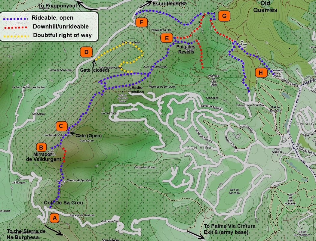
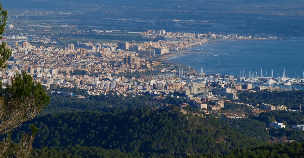
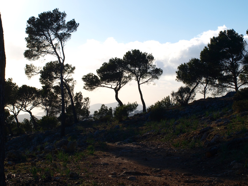
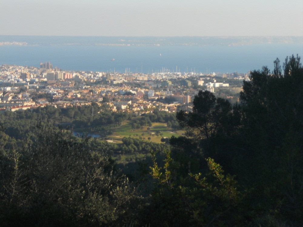
To the North East of the Coll de sa Creu (Pass of the Cross) lies a small hill range overlooking Palma, stretching 4 or 5 kms towards the village of Establiments, culminating at 500 meters at the Puig de Gats. The range is very close to town, can be easily reached in much less than an hour, and is an ideal - and popular- escape from the city. A number of old paved roads and fire tracks run along the hills ridges and slopes and are a great way to enjoy beautiful views on the city and mountains from a pretty much unspoilt natural vantage point.
Getting there
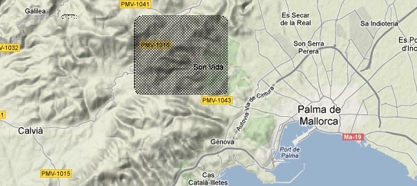
The Serra de Son Camps is best accessed from the Coll de Sa Creu, reached along a narrow asphalted road with virtually no car traffic, starting at exit 9 (Genova/ Son Dureta) on the Palma ring road. The climb from town is 6 km long with an altitude gain of 350 meters, roughly. Alternatively, the coll can be reached by the North from exit number 7A on the Via Cintura (Can Valero), taking the Puigpunyent road and branching off towards Calvia about 10 km out of town. This is longer, but a less steep a climb.
The Serra de Son Camps is best accessed from the Coll de Sa Creu, reached along a narrow asphalted road with virtually no car traffic, starting at exit 9 (Genova/ Son Dureta) on the Palma ring road. The climb from town is 6 km long with an altitude gain of 350 meters, roughly. Alternatively, the coll can be reached by the North from exit number 7A on the Via Cintura (Can Valero), taking the Puigpunyent road and branching off towards Calvia about 10 km out of town. This is longer, but a less steep a climb.
The trails
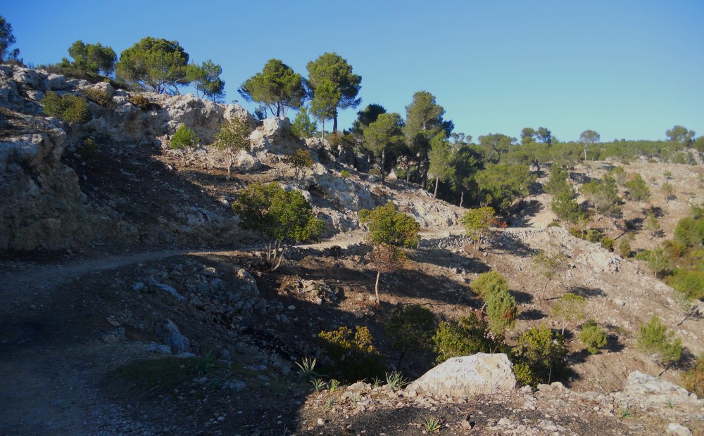
A wide track climbs the hill side to the right of the Coll de Sa Creu (A on map), barred by a chain between two pillars to prevent car access. The track is easily rideable for the first km or so, then turn into a steep deep rutted single track before flattening out towards the Mirrador de Valldurgent (fire lookout tower) and the Puig de Gats summit (B)
From here you follow the ridge, switching to the western side of the division wall, running along the crest at the unlocked gate .
The trails around here have been recently graded and are easy to ride, though steep in places. The downhill track toward point D is in excellent condition, but goes through private land and has a locked gate at its bottom exit (the easiest way around this gate is about 50 meters uphill (left) from the gate itself).
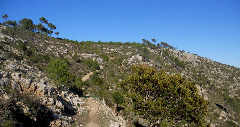
Continuing along the ridge trail you will soon reach the Puig de Revell (E), from where a very steep single track goes down to the Arabella Golf Club. Right of way here is unclear. Another very steep track, with partial remnants of concrete surfacing and huge ruts goes towards point G, a cross road between the ridge track and the old stone paved road across the hills.. Going left in a westerly direction is the easy alternative, this is a recognised right of way and will lead you to point F, from where it is a 20 min ride to the town suburbs. The east going track from point G, running directly downhill towards town has eroded away. It's very steep and rocky and most cross country cyclists will have to dismount at some stage. It will soon level out though, and after finding your way through a maze of trails you will come out somewhere to the north of the golf clubs (H), a short 20 minute ride away from downtown Palma (just follow the brand new dual carriage way to the right).
The total distance between the Coll de sa Creu (A) and the golf clubs (H) is around 10 km.
A wide track climbs the hill side to the right of the Coll de Sa Creu (A on map), barred by a chain between two pillars to prevent car access. The track is easily rideable for the first km or so, then turn into a steep deep rutted single track before flattening out towards the Mirrador de Valldurgent (fire lookout tower) and the Puig de Gats summit (B)
From here you follow the ridge, switching to the western side of the division wall, running along the crest at the unlocked gate .
The trails around here have been recently graded and are easy to ride, though steep in places. The downhill track toward point D is in excellent condition, but goes through private land and has a locked gate at its bottom exit (the easiest way around this gate is about 50 meters uphill (left) from the gate itself).
Continuing along the ridge trail you will soon reach the Puig de Revell (E), from where a very steep single track goes down to the Arabella Golf Club. Right of way here is unclear. Another very steep track, with partial remnants of concrete surfacing and huge ruts goes towards point G, a cross road between the ridge track and the old stone paved road across the hills.. Going left in a westerly direction is the easy alternative, this is a recognised right of way and will lead you to point F, from where it is a 20 min ride to the town suburbs. The east going track from point G, running directly downhill towards town has eroded away. It's very steep and rocky and most cross country cyclists will have to dismount at some stage. It will soon level out though, and after finding your way through a maze of trails you will come out somewhere to the north of the golf clubs (H), a short 20 minute ride away from downtown Palma (just follow the brand new dual carriage way to the right).
The total distance between the Coll de sa Creu (A) and the golf clubs (H) is around 10 km.