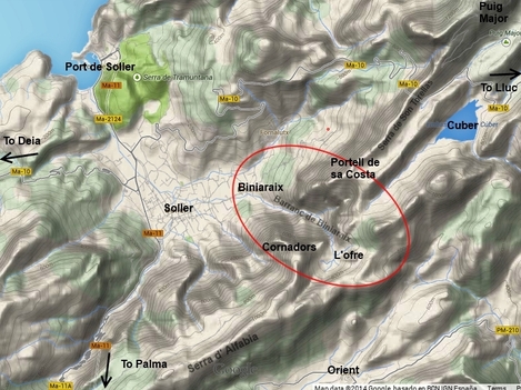
Time: 2 to 3 hrs from Biniaraix to L'Ofre farmstead, + 1 hr to the Grand Cornador. Circuit walk Biniaraix/ l'Ofre (or Torrent de es Verger)/ Portell de sa Costa/Biniaraix: 4 to 5 hrs, Biniaraix to Cuber 4 hrs.
Difficulty: Easy along the main path, complete range of levels on other paths/trails/route. Most trails are at the most of medium difficulty, but note that some of the more difficult cross country routes shown are exposed, difficult to navigate and require mountaineering skills and sometimes equipment. Falls have occurred, so if in doubt, hire a guide or abstain.
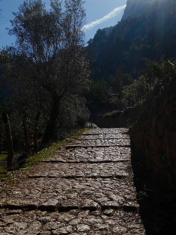
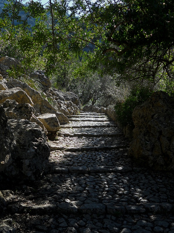
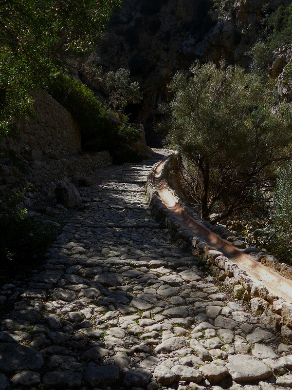
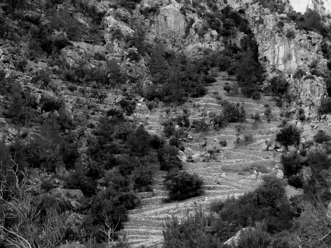
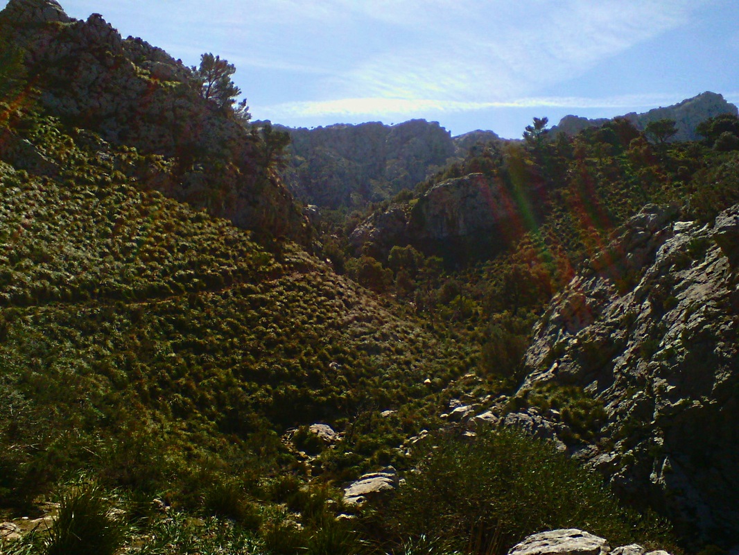
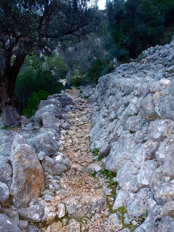
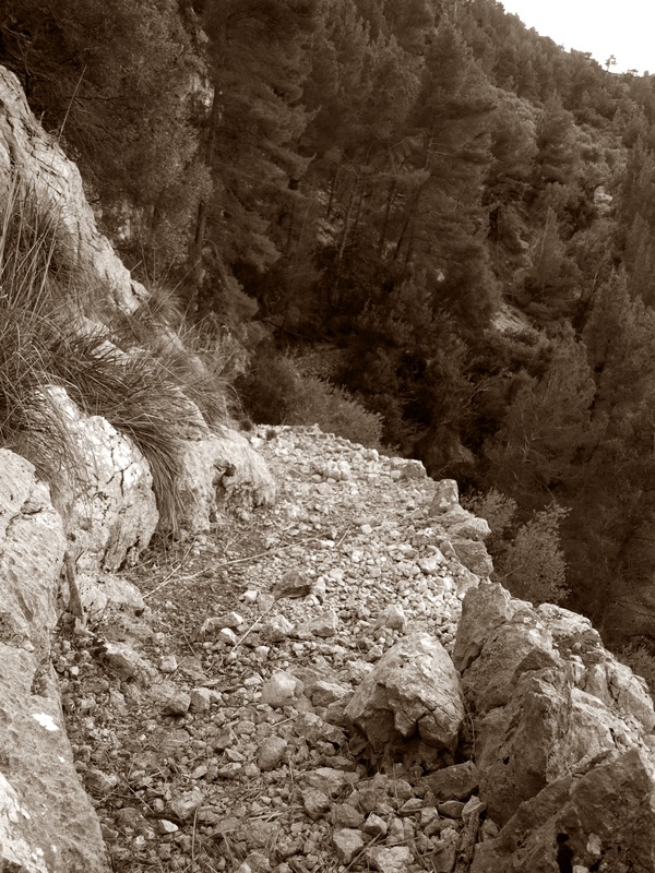
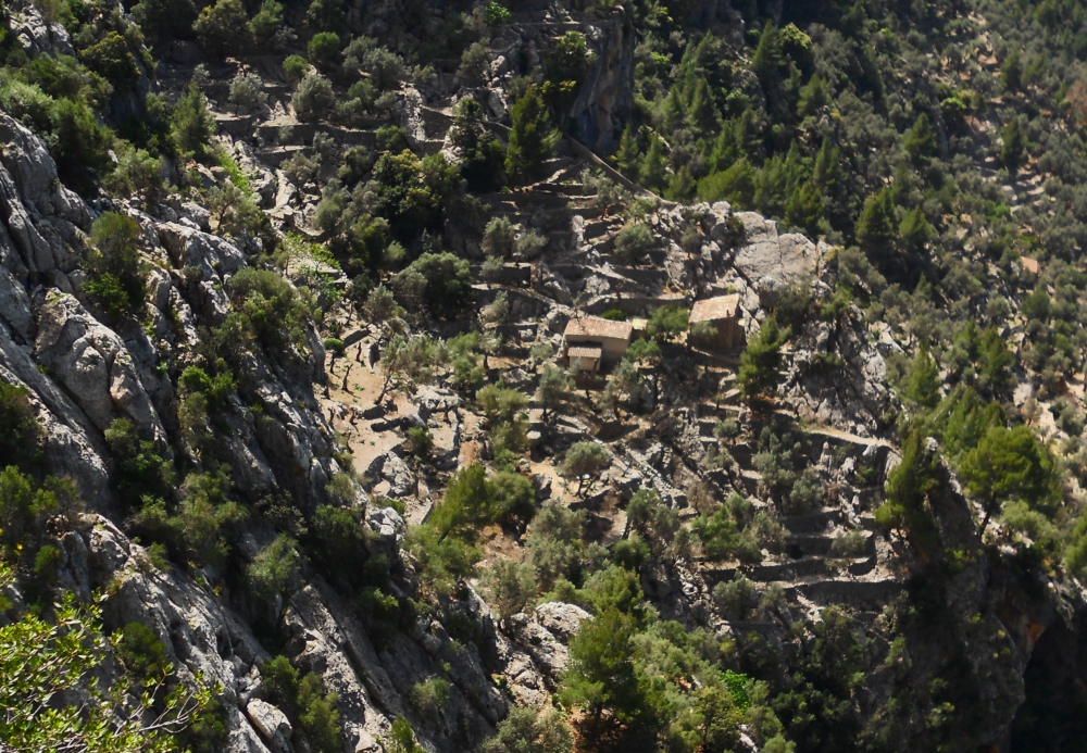
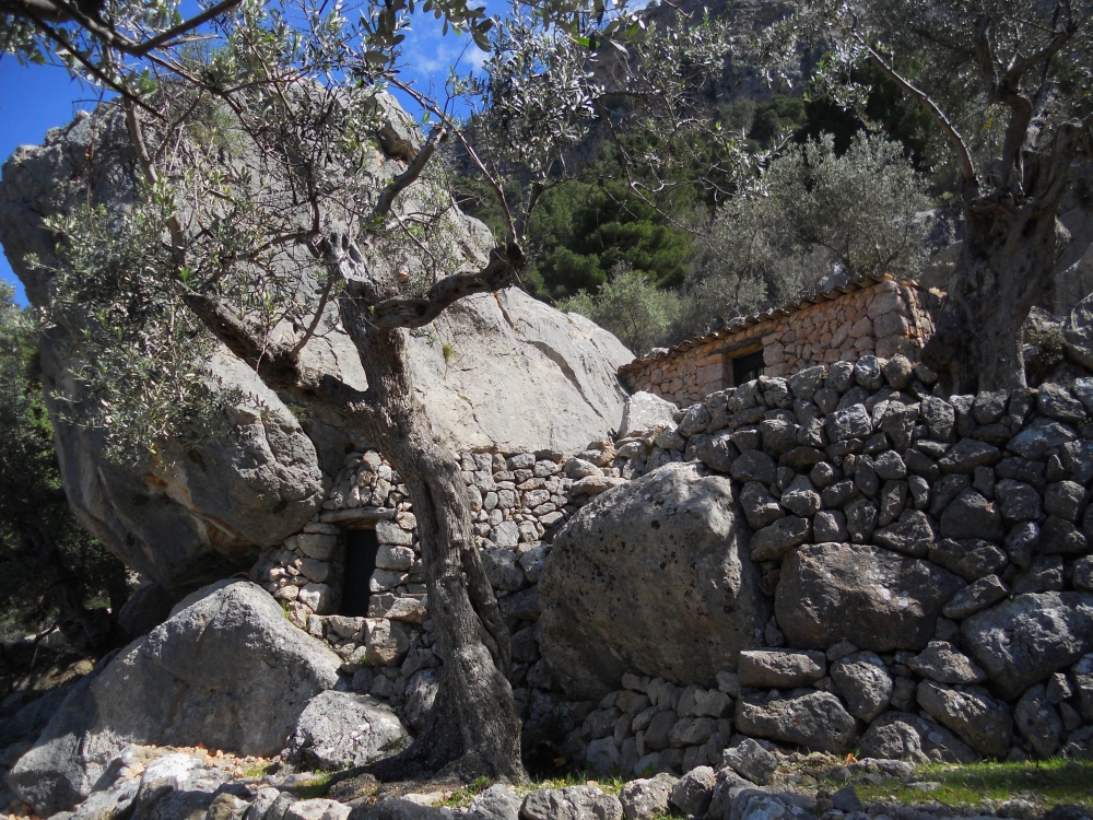
The Barranc de Biniaraitx is a deep gorge running north westwards into the Soller valley. The main Barranc dry stone road was built to link Soller with the farmsteads at the very heart of the Serra de Tramuntana,and with the monastery of LLuc and the plains beyond. It is an impressive path, winding its way up the steep slopes of the gorge, maybe one of the most outstanding examples of drystone engineering on the island. The Barranc itself was densely cultivated as witnessed by terraced olive groves culminating hundreds of meters above the torrent, sometimes resting above vertiginous cliffs with no apparent connection to the world below.
Whilst the main Barranc path was used as a major link between Soller, the Serra and the plains to the south (cattle and sheep were brought up to the hills this way during the summer months) many of the lesser paths were built by local farmers to reach isolated olive groves, springs and water points; there are many named passes up and along the apparently un-scalable cliffs, some easily overcome, others only for the hardy. Whether you are seeking a scenic and peaceful escape or are in search of vertiginous thrills, the Barranc has certainly more then one walk to your measure up its sleeve.
Difficulty: Easy along the main path, complete range of levels on other paths/trails/route. Most trails are at the most of medium difficulty, but note that some of the more difficult cross country routes shown are exposed, difficult to navigate and require mountaineering skills and sometimes equipment. Falls have occurred, so if in doubt, hire a guide or abstain.
The Barranc de Biniaraitx is a deep gorge running north westwards into the Soller valley. The main Barranc dry stone road was built to link Soller with the farmsteads at the very heart of the Serra de Tramuntana,and with the monastery of LLuc and the plains beyond. It is an impressive path, winding its way up the steep slopes of the gorge, maybe one of the most outstanding examples of drystone engineering on the island. The Barranc itself was densely cultivated as witnessed by terraced olive groves culminating hundreds of meters above the torrent, sometimes resting above vertiginous cliffs with no apparent connection to the world below.
Whilst the main Barranc path was used as a major link between Soller, the Serra and the plains to the south (cattle and sheep were brought up to the hills this way during the summer months) many of the lesser paths were built by local farmers to reach isolated olive groves, springs and water points; there are many named passes up and along the apparently un-scalable cliffs, some easily overcome, others only for the hardy. Whether you are seeking a scenic and peaceful escape or are in search of vertiginous thrills, the Barranc has certainly more then one walk to your measure up its sleeve.
Getting There.
Biniaraix is easily reached by car via Soller. Park on the main road at the entrance of the village.
You can also take the regular bus service from Palma (Plaza d'Espana) to Soller (the 211 Tunnel Express takes 1/2 hr against 1 1/2 hr for the 210 going via Deia and Valdemossa). From soller town bus station (Placa de America) go to the main square with the big church, take the Calle de La Lluna (the main shopping street) and go straight on till you reach Biniaraix 30 min later.
Many people feel that doing a whole loop up the Barranc and back down is too demanding, especially in the summer heat. A good option is to take the 8 am bus from Palma to Soller, and continue on the 9 am Soller to Can Picafort bus service via Cuber and Lluc. Get off the bus at Cuber reservoir, and walk back down along the well signposted GR 221, first around the dam, then over the col de l'Ofre, down to l'Ofre farmstead and down the gorge (barranc) to Biniaraix. This takes 3 to 4 hrs.
If you are looking for a pleasant alternative to the bus, the narrow gauge train still runs regularly between Soller and Palma.

The routes:
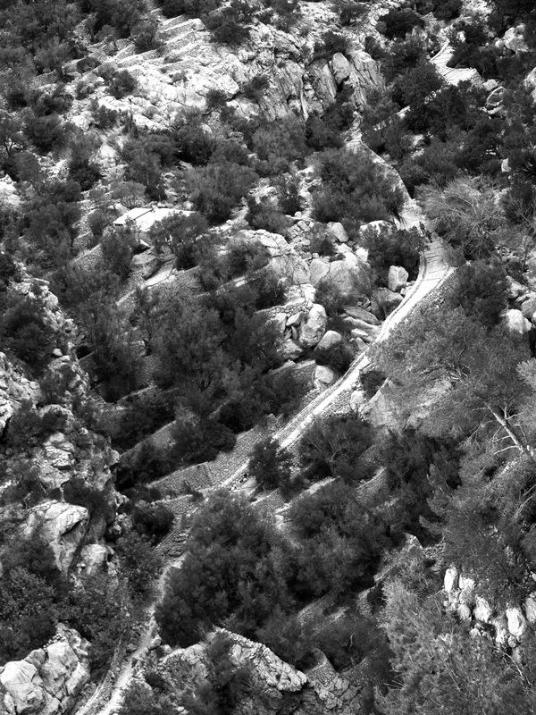
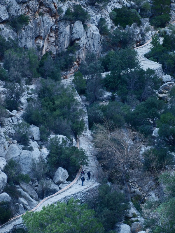
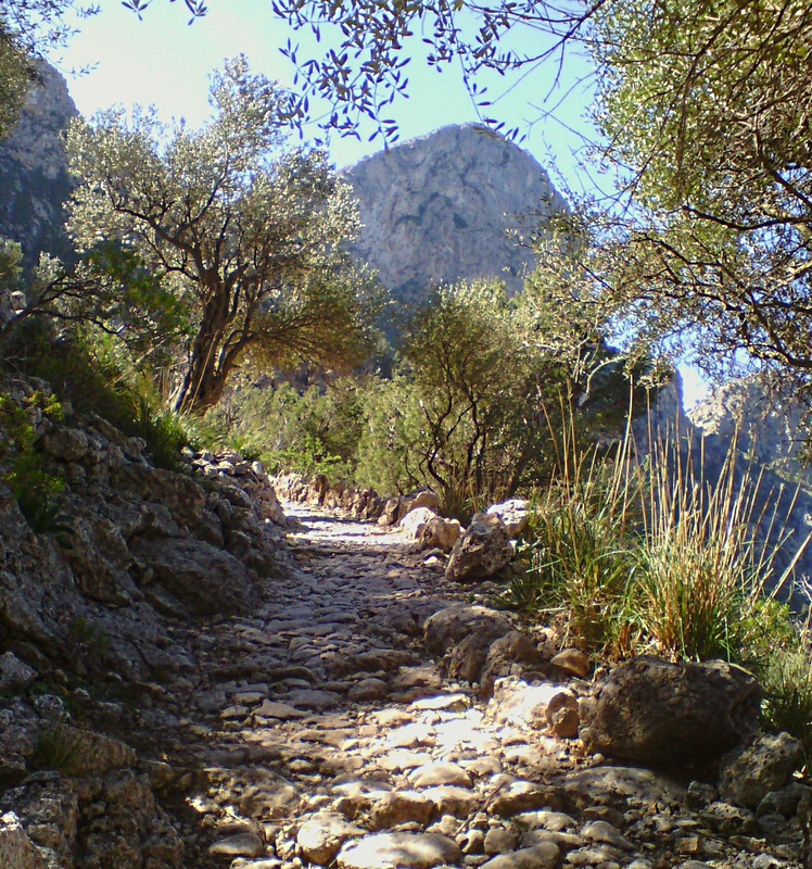
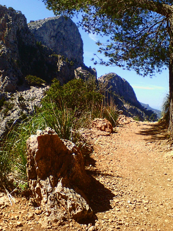
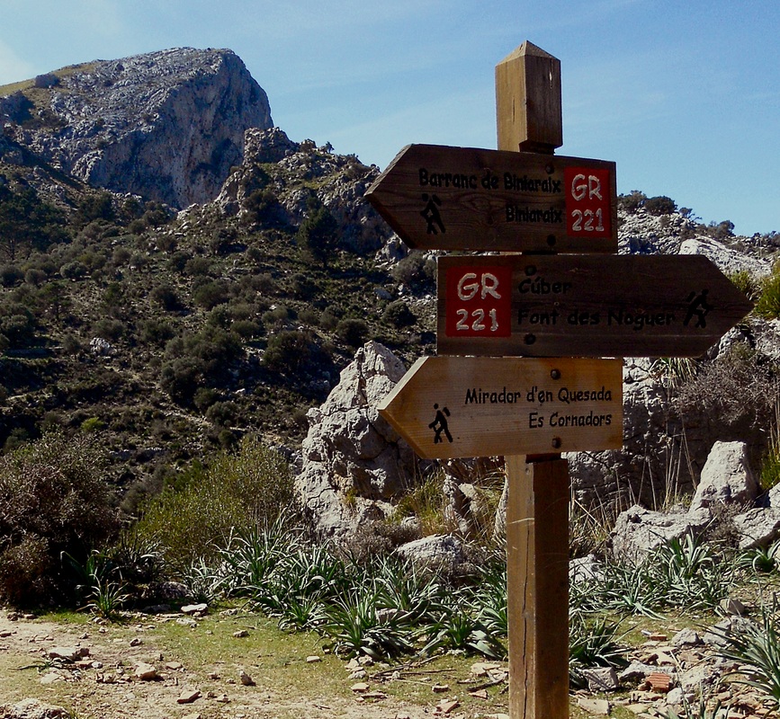
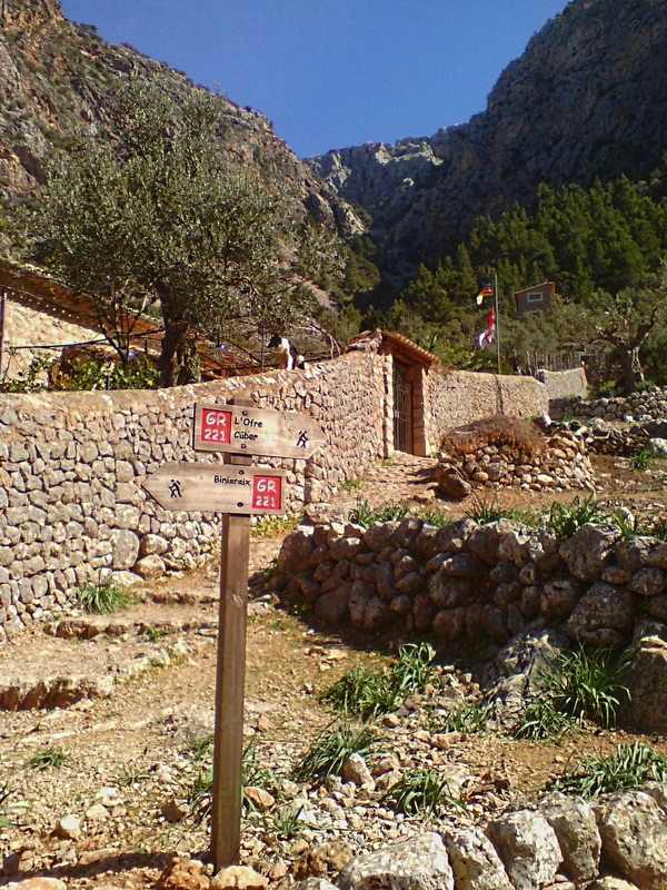
The main GR221 path starts in Biniaraix and is, as always, well signposted and easily followed. From Biniaraix, the climb is at first gradual, following the torrent at the bottom of the valley; once past the torrent d'es Verger, the path leaves the stream on the right bank to come above a set of cliffs that dominates the gorge. The way finally levels out to eventually reaching the farmstead of l'Ofre.
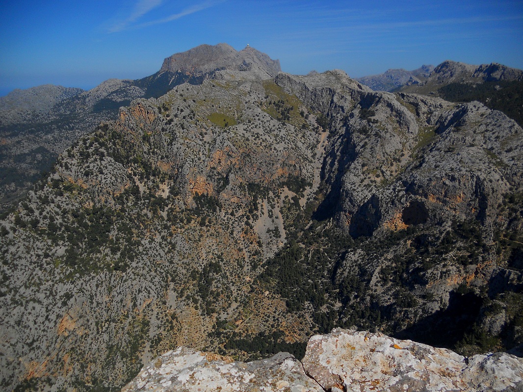
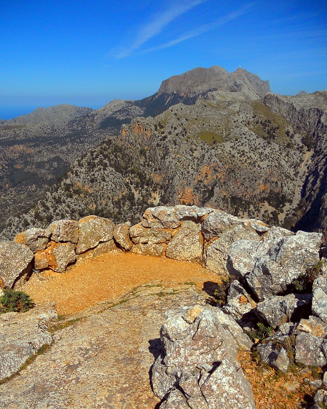
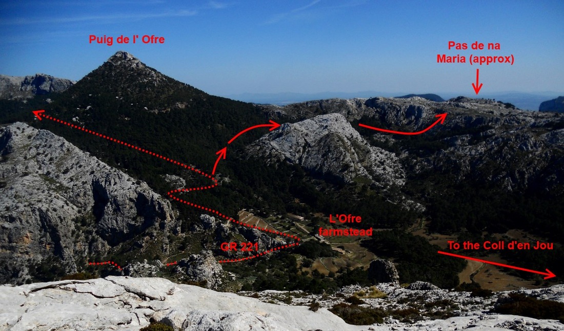
A turn off leading to the Grand Cornador will be reached just before that, a 1 hr detour well worth the effort for the fantastic views from the Mirador de Xim Quesada next to the summit. Note that the refuge (just a hut, no services) here is currently being rebuilt (2014). The inviting footpath you will find shortly before the summit leading westward to the beautiful farm of S'Arrom is closed to the public, and crossing the estate is forbidden. This eliminates any easy descent option on that side of the mountain.
On a return day walk, you can go back the way you came or:
The main GR221 path starts in Biniaraix and is, as always, well signposted and easily followed. From Biniaraix, the climb is at first gradual, following the torrent at the bottom of the valley; once past the torrent d'es Verger, the path leaves the stream on the right bank to come above a set of cliffs that dominates the gorge. The way finally levels out to eventually reaching the farmstead of l'Ofre.
A turn off leading to the Grand Cornador will be reached just before that, a 1 hr detour well worth the effort for the fantastic views from the Mirador de Xim Quesada next to the summit. Note that the refuge (just a hut, no services) here is currently being rebuilt (2014). The inviting footpath you will find shortly before the summit leading westward to the beautiful farm of S'Arrom is closed to the public, and crossing the estate is forbidden. This eliminates any easy descent option on that side of the mountain.
On a return day walk, you can go back the way you came or:
- try to return via the Pas de ses Lloses (difficult), Cami d'Aladern or just take the the Cami Vell de Biniaraix (easy) on the other bank of the torrent, visiting en route the unique Cave des Alfabies. See next paragraph.
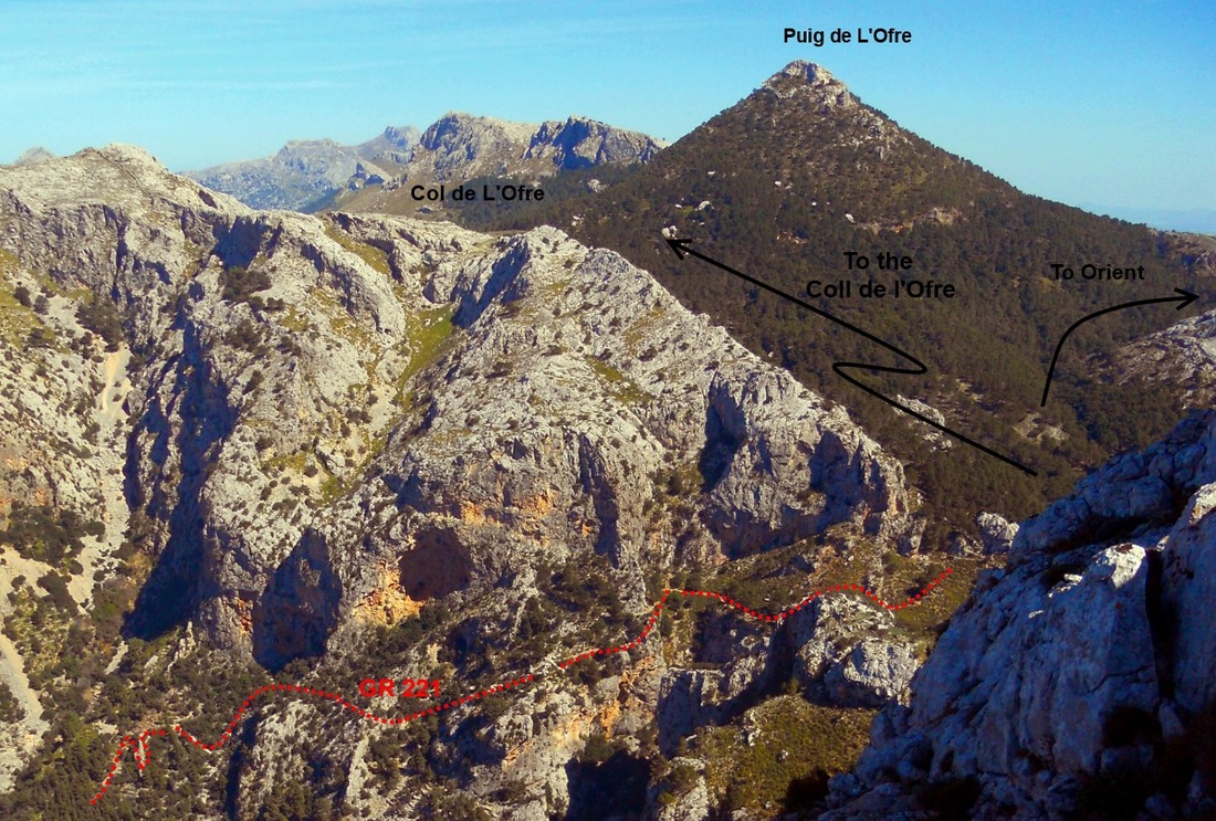
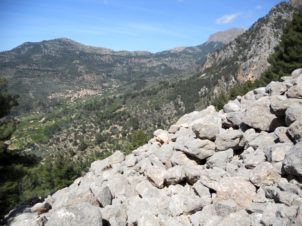
- continue to the Col de l'Ofre from where you can turn left to the Portell de sa Costa (1 to 1 1/2 hr), a beautifully located gateway, with stunning views over Fornalutx, placed on a wall following the ridge of the Serra de Son Torellas, from where you can either follow the steep zig zaging rocky footpath back to Biniaraix or Fornalutx, or take a right along the peaceful Val de son Torellas to the Tunnel de Monaber and on to catch the bus back to town from Cuber (5 pm). Or you could go down the huge scree valley leading to the spring d'Es Verger and the main Barranc path via the pas de s'Encletxa (medium difficulty, see next paragraph).
- continue to the Col de l'Ofre and straight to Cuber (2 hrs) to catch the bus service No 354 to Soller at around 5 pm (April to October only).
- Take the unmarked but easily identified trail curling behind the north east side of the Puig de na Maria and go cross country southwards to the Pas de na Maria, down the pass, through the Coma Sema estate and to Orient (2 hrs) from where you can catch the 221 bus service to Bunyola (service on request only, follow instructions on linked timetable).
- Go westwards from L'Ofre farmstead to the Coll de Puig de Jou and on to the Serra D'Alfabia and the antenna station, from where you will find a path back down to Soller (4 hrs). This is a rewarding but long and slightly more difficult route.
Other routes around the Barranc:
South Bank:
North Bank
South Bank:
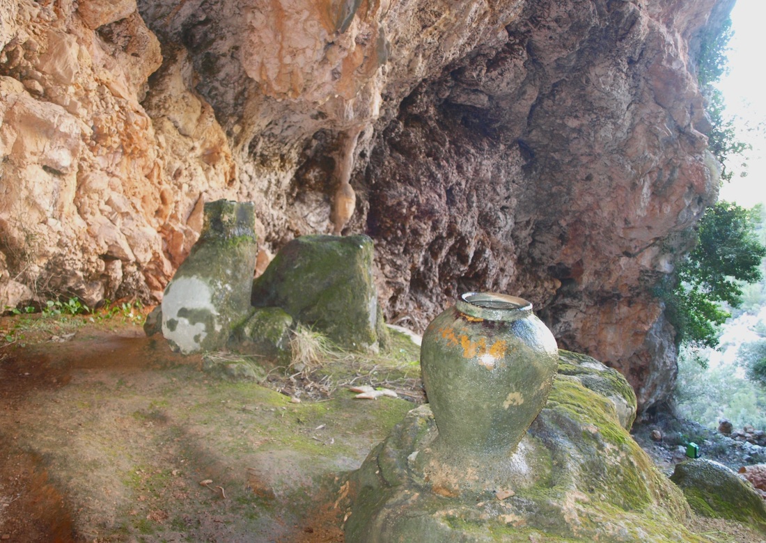
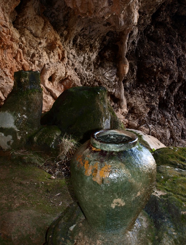
- Cami Vell: the old footpath on the bottom section of the Barranc starts about 15 minutes away from Biniarraix village and finishes just above the point where the Es Verger stream joins the main torrent. It is a rocky path, that takes you quite high on the southern side of the gorge, over the coll d'en Se and back down to the torrent further upstream. The views are excellent, but the main attraction along this route is the small detour to the caves des Alfabies , a shallow grotto where clay pots have been positioned under water drips from the ceiling and have somehow been pertified, cemented by the minerals in the water. There is also an interesting face carving in one of the limestone formation.
- Cami d'Aladern: This is a very much disused footpath, and probably the one I like best in the whole Barranc. It clings on the southern slopes, climbing above the first set of waterfalls. The start of the path at its bottom end is not easy to find. Going up the Cami Vell, you have to turn off to the right once you pass the last small house on the downhill part of the trail past the coll d'en Se. If you reach the main torrent, you have gone too far. The cairns on the lower terraces showing the start of the Cami d'Aladern have been destroyed by the land owners; don't let it deter you, once you find the path it is easily followed.
- The Cami d'Aladern takes maybe 30 min to cover and finishes by the torrent, above the main waterfalls and just bellow the higher set of waterfalls. At this point, the more daring can cross the torrent and follow the cliff edge footpath through the pas de Ses Lloses, on the northern bank, returning this way towards the main GR 221 highway (see north bank section further on). It is also possible to follow the bottom of the gorge uphill from here when the torrent is not running too hard and reach the start of the path to the Grand Cornador. This last route is not easy.
North Bank
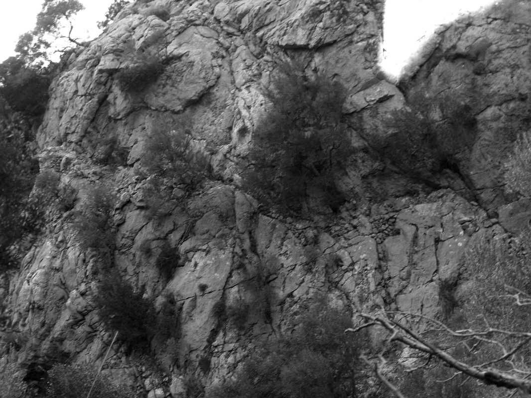
- The Pas de ses Lloses, 'Pass of the Slabs', is not for the faint hearted, as the built path is less then a foot wide in places, with a 100 feet very vertical drops on the side. It is not difficult to overcome, but very impressive; the tricky bit involves going around a rocky outcrop where the slabs are. The pas is signposted by a red arrow at the river side as well as cairns on both sides, and is easily identified. Once you leave the pas and reach the olive terraces, just follow the cairns leading you back to the main GR 221 path. Coming the other way, the turn off to reach the Pas des Lloses and Cami de 's Aladern from the main GR 221 path is marked by a hollow olive tree trunk filled with stone on the left hand side of the path going uphill.
- Es Verger shortcut: this route joins the main Barranc GR 221 to the Portell de sa Costa along the torrent de Es Verger at first, then up a steep scree and boulder valley. This is a steep route, not difficult, but with a long climb on what is at times slippery ground; it is overall a faster but much harder way to reach the Portell then the long way around via l'Ofre. The turn off from the GR 221 is just across from the very recognisable farm of Can Cati on the south bank, on a stepped trail leading steeply uphill perpendicular to the GR, edged on the left by a large, fenced rustic villa with a flag pole and swimming pool (!) and on the right by some smaller houses further uphill. Cross the torrent d'es Verger to the west bank at the first turn off, and then follow the stepped path uphill for two bends. A lesser path to the right will take you up towards the bank of the torrent; some local idiot has sprayed grey paint over all the markings showing the way and destroyed most of the cairns, but the way is quite clear... just aim towards the big scree valley and up to the spring of Es Verger, from where you go up the boulder and scree slope all the way up (1 h or more), past the pine trees, up the grassy bit at the top of the valley, over the boundary wall.... and you are there, top of the world!
- Pas des cable: this an other hard core route that I have not experimented on, located slightly to the west of the es Verger shortcut, leading also towards the Portell de sa Costa. The start of the trail up is easily found, a few hundred meters below the Es Verger torrent junction. The path however soon ends, and it is then a cross country climb on very steep ground. A wire cable has been laid to help on the steepest, almost vertical, grassy bit , but is difficult to find. An interesting adventure for those that have already done it all.
You can download a printer friendly PDF version of this page here.
Cross country climbing routes
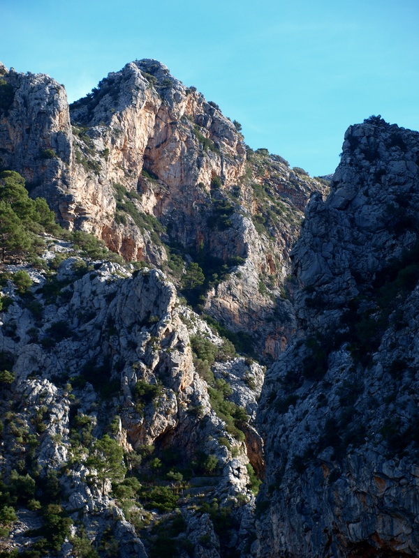
- Cornicha des Cornadors & Cornador Petit: From the main footpath going up to the Mirador de Xim Quesada, it is possible to go cross country under the NE cliffs of the Grand Cornador, and push on to climb the Cornador Petit. The route under the cliffs is not difficult, but the contour of a small outcrop (known as point 754) on the western side at the foot of the wee Cornador, as well as the ascent to the summit itself is somehow exposed and complicated. There are two other routes reaching the corniche from the bottom of the Barranc, through the Pas d'en Querol and the Pas de s'Angles. These are difficult, exposed routes and require a good head for heights and some rock climbing experience. The Pas d'en Querol is often used on the climb and the Pas de's Angles on the descent, as a rope is needed on the later to overcome 10 & 5 m vertical drops. The overviews that follow have been put together from third parties accounts as I have not climbed either of those 'Pas' myself.
- Pas d'en Querol: This is the first cross country route to the Grand Cornador corniche that starts off just after the col d'en Se. The first section of the climb is done going up a long gully covered with scree, rocks and grass till a point right under a set of cliffs. At the top of the slope a small, exposed and acrobatic transverse ledge (pas d'en Querol) on the right allows you to reach a more scramble-able section of the upper reaches from where you get onto the main Corniche. Here is a link to a graphic description.
- Pas de s'Angles and Pas d'en Careta: The Pas de s'Angles is called so because a Britisher fell to his death here in the 1980's; it took a number of years for his body to be found. It is the shortest way down from the Cornador Petit area. The pas starts at the top of the gully over the barranc between point 754 and the Cornador petit; a rope is needed on an initial 10 m vertical drop down a small gully, beyond which a small cimb leads you to a transverse, very exposed, ledge to the left has to be followed in a NW direction. A further 5 m drop enables you to find less vertical ground to contour the Cornador petit, over a ridge and on to the next pas kitted with some iron nails to facilitate the descent. Then it is down a scree slope with some huge boulders and onto the main footpath at the bottom of the Barranc. Follow this link for more.
- Pas des cable: this an other hard core route that I have not experimented on, located slightly to the west of the pas de's Encletxa, leading also towards the Portell de sa Costa. The start of the trail up is easily found, a few hundred meter below the Es Verger torrent junction. The path however soon ends, and it is then a cross country climb on very steep ground. A wire cable has been laid to help on the steepest, almost vertical, grassy bit , but is difficult to find. An interesting adventure for those that have already done it all.
Pas d'en Capet & Pas de sa Servera
Unfortunately, access to this route has been made difficult by the fencing off of many tracks in the Soller region. Part of the walk goes through the s'Arrom estate, an area where walkers are not welcome. At the time of writing (2014) a fence is under construction at the foot of the pas de sa Servera. This was a nice route through some amazing hill side terraced olive groves, but is sadly not worth the hassle anymore given the right of way issues. Here follows the original description:
'This round route from Soller to Biniaraix does not strictly belong to the Barranc de Biniaraix area, but finishes at the mouth of the gorge so is listed here. It is a moderately difficult route, circling the bottom half of the s'Arrom estate. It follows a mixture of trails, from cross country to ancient footpaths to 4WD dirt tracks. The start off is, as for many a trail, at the cemetery in Soller, and will take you in a vast, anticlockwise crescent over the hills to Biniarraix in about 3 to 4 hrs, over two moderately difficult scrambles. The route is best described by this very valuable and complete link; just follow the Soller Alpina map for the rest! '